The growth of smartphones has made numerous tasks much easier to accomplish. Surprisingly, you can even use them for land surveying now! This article will explain how to survey land with just your smartphone. We’ll discuss the good and not-so-good sides of using your phone for surveys. Plus, we’ll share some easy tips to help you do your survey. So, let’s dive into the world of smartphone land surveying!
Why do you need to survey your land?
Surveying your land is super important for owning and managing property. First off, it helps you know exactly where your land starts and ends, which is crucial for avoiding conflicts with neighbors over boundaries. Plus, it lets you protect your rights to your property.
Also, doing a land survey helps you understand your land’s landscape. You’ll learn about things like hills, water, and landmarks, which are vital for managing your land well. Whether you’re building stuff, farming, or landscaping, knowing your land’s features is key.
For homeowners, farmers, and developers, a precise survey is a must for any construction work. It gives you the exact measurements and boundaries you need to plan and build things like fences, buildings, and roads. This way, your projects can follow the rules and be done right.
When you survey your land, you’re not only managing it better, but you’re also avoiding legal problems. Having clear records of your property’s boundaries and features can save you from disputes with neighbors or trespassing issues. So, getting a proper land survey is a smart move to protect your property rights and stay on the right side of the law.
How is it usually done?
Land surveying has long been done by professionals using fancy tools like total stations and GPS receivers. They start by checking property documents to know where the boundaries are. Then, they go out into the field and carefully measure everything using these high-tech gadgets.
Total stations are like super rulers that measure distances, angles, and heights very precisely. They use lasers and fancy optics to do this. GPS receivers, on the other hand, use signals from satellites to figure out exactly where you are on the Earth’s surface. This helps surveyors make accurate maps of large areas of land.
During the survey, surveyors put markers like stakes or pins to show where the property lines are. These markers help property owners and builders see exactly where their land starts and ends.
Can you survey using your smartphone?
The advent of GPS-enabled smartphones has sparked the possibility of using these devices for land surveying. Both Android and iPhone devices come equipped with GPS functionality, allowing users to pinpoint their location accurately. However, the question remains: Can smartphones adequately replace traditional surveying equipment for land surveying purposes?
How will you do that?
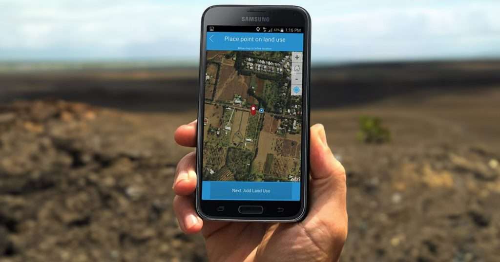
Indeed, you can survey your land using just your smartphone, regardless of whether it’s an Android or iPhone. Here’s a straightforward guide:
- Choose the Right App: Start by selecting a surveying app compatible with your smartphone’s operating system. Popular options include GPS Field Area Measure for Android and MapPad GPS Land Surveys for iOS.
- Enable GPS: Make sure to enable the GPS function on your smartphone and ensure it has a strong signal reception for accurate measurements.
- Set Up the App: Input the coordinates or address of your property into the surveying app to define the survey area accurately.
- Start surveying: Take a stroll around the perimeter of your property while holding your smartphone. The app will track your movements in real time, providing precise location data.
- Mark Property Lines: Utilize the app to mark property lines, corners, and any significant landmarks on your property accurately.
- Save and Analyze Data: Once you’ve completed the survey, save the collected data within the app. You can then analyze it to determine property boundaries and gather other pertinent information.
Is the resulting survey accurate?
While smartphones are incredibly convenient and accessible, their accuracy for land surveying can vary. Many factors affect how precise smartphone surveys are, like the strength of the GPS signal, how well the device is calibrated, and the reliability of the surveying app. It’s important to realize that smartphone surveys might not have the pinpoint accuracy needed for tasks like settling property boundary disputes or planning construction projects. So, while smartphone surveys can offer useful information, they might not always be accurate enough for making critical decisions.
The pros and cons of using smartphones for surveying
Pros
- Cost-Effective: Using smartphones for land surveying is cost-effective. It saves money by removing the need for expensive surveying equipment and professional services. This makes smartphone surveys a wallet-friendly option for property owners.
- Accessibility: Surveying apps can be effortlessly downloaded and utilized by anyone with a smartphone, democratizing the process of land surveying. This accessibility empowers property owners to take charge of their land management and make informed decisions.
- Convenience: Smartphone surveys afford unparalleled convenience, enabling property owners to conduct surveys at their convenience. Whether in the field or at home, users can quickly gather data and assess their land without relying on external assistance.
Cons
- Accuracy Limitations: Despite advancements in GPS technology, smartphone surveys may not consistently deliver the same level of accuracy as professional surveying equipment. Variability in GPS signal strength and device calibration can result in discrepancies in survey results, potentially impacting the reliability of the data collected.
- Reliability Issues: Signal interference, battery drain, and software glitches are common challenges encountered during smartphone surveys. These reliability issues can undermine the integrity of the survey data, necessitating caution when relying solely on smartphone surveys for critical decisions.
- Legal Validity: One big worry about smartphone surveys is their legal validity. In a lot of places, smartphone surveys might not be seen as legally binding documents in property disputes or legal matters. That’s why property owners should be careful and think about asking professional surveyors for tasks that need legal recognition and accuracy.
It is possible to survey land using smartphones
Using smartphones for land surveying is cheaper and easier, but it’s not perfect. They’re okay for basic surveys, but they might not be accurate or legal enough for important stuff. It’s smart to think about the good and bad points before using your phone for surveys. Sometimes, it’s better to ask the experts for help. Still, if you know what you’re doing and use your phone wisely, you can survey land with it.